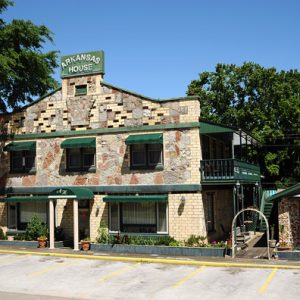
 Arkansas House Inn
 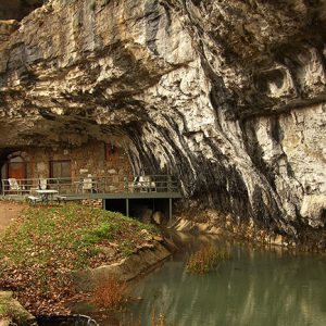 Beckham Creek Cave
 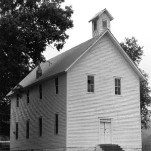 Boxley Community Building
 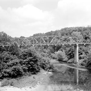 Buffalo River Bridge
 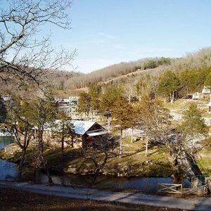 Dogpatch USA
 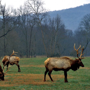 Elk at Ponca
 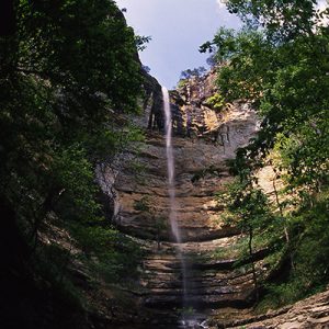 Hemmed-in Hollow
 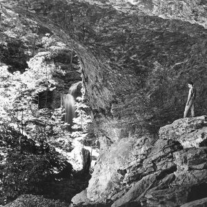 Hemmed-in-Hollow
 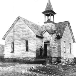 Jasper Methodist Church
 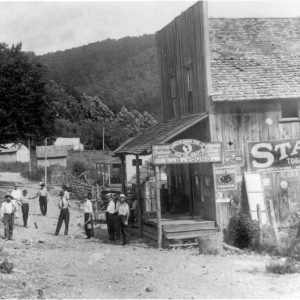 L. G. Young Store
 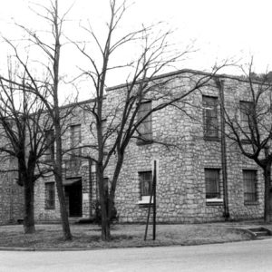 Newton County Courthouse
 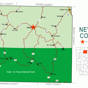 Newton County Map
 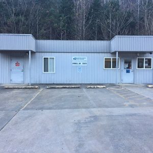 Ponca Post Office
 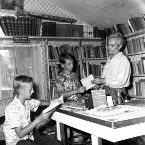 Ted Richmond
 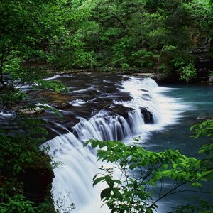 Richland Creek
 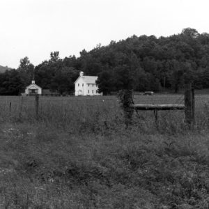 Walnut Grove Church
 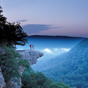 Whitaker Point
 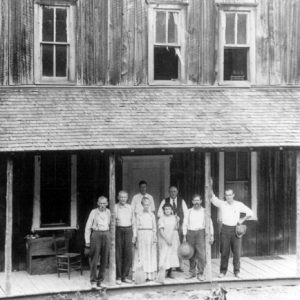 Whiteley’s Hotel
501-918-3025
calsfoundation@cals.org
calsfoundation@cals.org
| Region: | Northwest |
| County Seat: | Jasper |
| Established: | December 14, 1842 |
| Parent County: | Carroll |
| Population: | 7,225 (2020 Census) |
| Area: | 821.07 square miles (2020 Census) |
| Historical Population as per the U.S. Census: | |||||||||
|
1810 |
1820 |
1830 |
1840 |
1850 |
1860 |
1870 |
1880 |
1890 |
1900 |
|
– |
– |
– |
– |
1,758 |
3,393 |
4,374 |
6,120 |
9,950 |
12,538 |
|
1910 |
1920 |
1930 |
1940 |
1950 |
1960 |
1970 |
1980 |
1990 |
2000 |
|
10,612 |
11,199 |
10,564 |
10,881 |
8,685 |
5,963 |
5,844 |
7,756 |
7,666 |
8,608 |
|
2010 |
2020 |
|
|
|
|
|
|
|
|
|
8,330 |
7,225 |
|
|
|
|
|
|
|
|
| Population Characteristics as per the 2020 U.S. Census: | ||
| White |
6,689 |
92.6% |
| African American |
7 |
0.1% |
| American Indian |
71 |
1.0% |
| Asian |
24 |
0.3% |
| Native Hawaiian or Other Pacific Islander |
2 |
0.0% |
| Some Other Race |
31 |
0.4% |
| Two or More Races |
401 |
5.6% |
| Hispanic Origin (may be of any race) |
82 |
1.1% |
| Population Density |
8.8 people per square mile |
|
| Median Household Income (2019) |
$38,082 |
|
| Per Capita Income (2015–2019) |
$19,735 |
|
| Percent of Population below Poverty Line (2019) |
15.8% |
|
Located in the Boston Mountains, Newton County can be described as mountainous, rural, and isolated. The land, once respected and protected by Native Americans, has come full circle with a large portion being protected by the U.S. Department of the Interior as a wilderness area.
Louisiana Purchase through Early Statehood
The area, rich with game and timber, was watered by the Big and Little Buffalo rivers. Until 1808, the Osage claimed the region, and between 1818 and 1828 the land was part of a reservation granted to the Western Cherokee. The county was part of Carroll County when it was created in 1833, and white settlers quickly moved in. A block of marble taken from a hillside near present-day Marble Falls was used to help build the Washington Monument. Although Jasper appeared on maps in 1840, it was not incorporated until 1896.
The state legislature created Newton County on December 14, 1842, naming it after U.S. marshal Thomas Willoughby Newton. After beginning his career as a mail carrier and serving as U.S. marshal for Arkansas, Newton was elected to serve in Congress after the resignation of Archibald Yell. John Belleh’s house on Shop Creek was designated the county seat until the designation was given to Jasper in 1843. The county had ten post offices by 1856.
The terrain made the area unattractive to land speculators, which was encouraging to people who could not afford land in other parts of the state.
A school opened at Mount Judea around 1860. Western Grove Academy opened in 1886. Hunting and small farms sustained the residents, and livestock grazed the rugged land. The difficulty in farming the rough terrain resulted in farms being located on the softer ground along the river. In 1850, there were fifty-one slaves in the county; by 1860, that number had decreased to twenty-four, with 3,369 white residents.
Civil War through Reconstruction
While neighboring Carroll, Boone, Madison, and Searcy counties saw a decrease in population and livestock in the Civil War years, the isolation of Newton County resulted in an increase in both at the start of the war. As in other counties, neighbors and families split as loyalties were divided between the Union and the Confederacy. Guerrilla warfare and skirmishes between Union and Confederate troops caused turmoil. Some residents lived in caves, while others fled. Former sheriff John Cecil led a guerrilla band in the county, operating against Union forces. Union soldiers destroyed the Confederate saltpeter works at Boxley, and Jasper was burned. Engagements in the county included three separate skirmishes in April 1864: Whiteley’s Mills, Richland Creek, and Limestone Valley.
After the war, families returned to their previous way of life. They grew corn, wheat, rye, oats, tobacco, and potatoes. Produce was shipped to Clarksville (Johnson County), Buffalo Shoals (Marion County), and Springfield, Missouri. Lead, zinc, and saltpeter were mined. The number of African Americans in the county decreased to seven by 1870.
Post-Reconstruction through the Gilded Age
Farming changed little in the county after Reconstruction. Smaller farms were prevalent, while larger farms existed near the rivers. Potatoes, apples, and peaches supplemented the main crop, corn. Cotton provided the cash crop for the Buffalo River valley. Lumber camps developed. Whether for added income or personal use, the production of moonshine made use of the surplus corn. A legend was born as “Beaver Jim” Villines became known for his trapping ability. Visitors went to Marble Falls and Tom Thumb Spring for the water’s supposed healing power.
Early Twentieth Century through the Modern Era
The 1900s brought increased population as outsiders moved to the county. Land speculators bought property. The county reached its largest population of 12,538 in 1900, including two African Americans. By 1930, no African Americans were reported in the county. The decline was attributed to isolation, economic factors, and race riots in nearby Harrison (Boone County).
Lead and zinc mining increased briefly to support the World War I efforts. One county resident, John Henry Pruitt of Fallsville, received the Medal of Honor twice for his actions during the war. Some resistance to military service existed in the county, leading to the almost completely bloodless Newton County Draft War in 1918.
Ponca was established on land sold to Ponca City Mining of Oklahoma. Tourists made the trek to Hemmed-in Hollow to see the rugged beauty of the area and the tallest waterfall between the Appalachian and Rocky Mountains and to tour the “Ace of World Caverns,” Diamond Cave. One-room schools were forced to consolidate. With the rough terrain, lack of a railroad, and poor roads, farmers continued to work small farms. While the population of other counties decreased during the Depression, Newton County saw an increase, though tourism declined during the same period. The Lurton Furniture Factory produced chairs. By World War II, the company had become the Sutton Handle Factory and was selling its handles to the United States government. On February 6, 1948, a B-25 bomber crashed into Round Top Mountain near Jasper.
Change came slowly. Newton County resident Ted Richmond opened the first library, a private endeavor called the Wilderness Library. Jay Smith opened the first airports, one at Piercetown in 1946 and the other in Boone County in 1951. Also in 1951, Newton County acquired its first paved road when Highway 7 was paved from Jasper to Harrison.
The 1960s and 1970s brought diversified change to Newton County. New residents arrived with the back-to-the-land movement. Santuario Arco Iris, an intentional land community founded by Maria Christina DeColores Moroles, serves as a refuge for women and children, especially those of color. The popularity of the comic strip Li’l Abner created interest in an amusement park, and with a name change, Marble Falls became Dogpatch. Dogpatch USA opened in 1968 and employed residents of Newton County and neighboring Boone County, both in the construction of the park and as employees. The amusement park never hosted the projected number of visitors (one million by its tenth year). When the comic strip ceased publication, the free publicity disappeared, and the park’s isolated location failed to draw the anticipated traffic. Financial problems brought changes in ownership, and after several attempts to revive the park, it closed in 1993. At the request of the residents, Dogpatch once again became Marble Falls.
The Buffalo River became the Buffalo National River in 1972. Under the National Park Service, such locations as Beaver Jim Villines’s home, Boxley Valley, and Lost Valley became tourist spots. The introduction of elk into the area from 1981 to 1985 resulted in Newton County being declared the Elk Capital of Arkansas in 1998. Founded in 2002, the Ponca Elk Education Center helps visitors to the county view the animals. Healthcare and social assistance provide the most employment in the area. Consolidation of the state’s rural districts forced Newton County’s schools to merge, leaving only three districts. Two of the districts include towns from surrounding counties. Western Grove is the only incorporated town, along with Jasper, in the county.
Located in Newton County near Ponca, the Big Buffalo Valley Historic District (also known as the Boxley Valley Historic District) includes a number of historic structures dating between 1879 and 1930. Also included in the district are a number of archeological sites representing prehistoric peoples. The sites in the district are scattered across the entire valley, which measures more than 8,000 acres. The district was added to the National Register of Historic Places on July 29, 1987, with the original application amended on November 7, 1990.
Additional historic sites in the county include the Little Buffalo River Bridge, the Newton County Courthouse, and the Parker-Hickman Farm Historic District.
Famous Residents
While at Washington University, the Royal Victoria Hospital in Montreal, and Ford Hospital in Detroit, Newton County native Dr. William A. Hudson studied iodine levels in blood. His studies resulted in the production of iodized table salt in 1924. Newton County native William Stiritz was named chairman of Ralston-Purina in 1982. Area resident Tim Ernst is a wilderness photographer and noted writer. James Carl Hefley, a Mount Judea native, wrote the Way Back in the Hills series of books that was published from 1985 to 1996. His brother Howard “Ozark Monk” Hefley wrote the Way Back in the Ozarks books published in 1992 and 1993. Local artist Max D. Standley captured the moments before a Newton County plane crash in his famous painting, Crash on Round Top.
For additional information:
Blevins, Brooks. Hill Folks: A History of Arkansas Ozarkers and Their Image. Chapel Hill: University of North Carolina Press, 2002.
Hardaway, Billie Touchstone. These Hills, My Home: A Buffalo River Story. Bossier City, LA: Everett, 1991.
Lackey, Walter Fowler. History of Newton County, Arkansas. Independence, MO: Zion’s Printing and Publishing, 1950.
Newton County Historical Society Newsletter. Jasper, AR: Newton County Historical Society (1985–).
C. J. Miller
Springdale, Arkansas
Revised 2022, David Sesser, Southeastern Louisiana University


Comments
No comments on this entry yet.