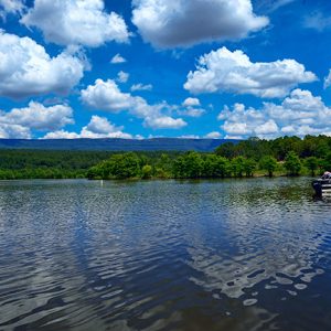
 Blue Mountain Lake
 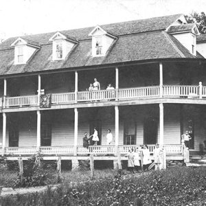 Burnette Springs Hotel
 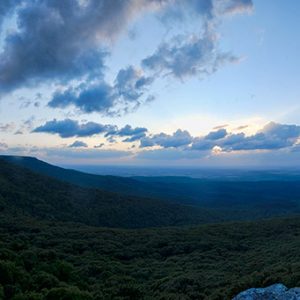 Cameron Bluff
 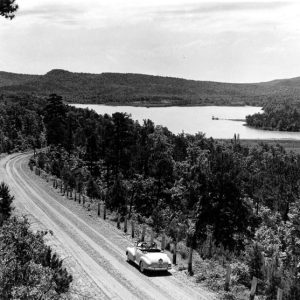 Cove Lake
 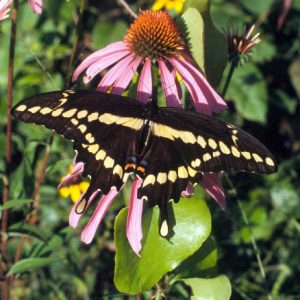 Giant Swallowtail Butterfly
 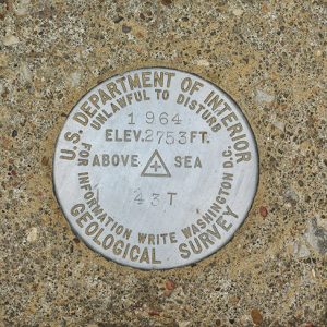 High Point Marker
 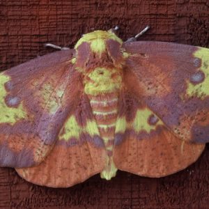 Imperial Moth
 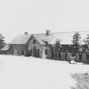 Lodge on Mount Magazine
 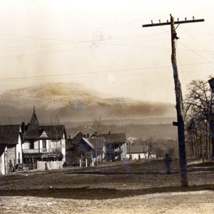 Magazine Street Scene
 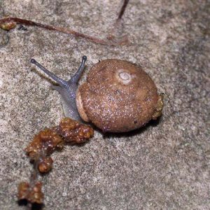 Mount Magazine Shagreen Snail
 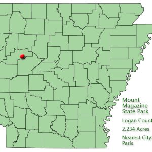 Mount Magazine State Park: Park Location
 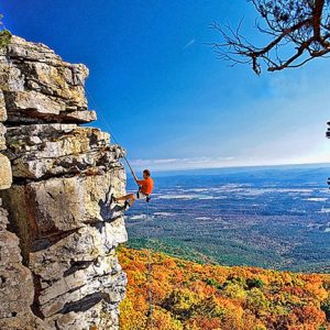 Mount Magazine State Park
 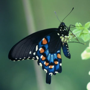 Pipevine Swallowtail
 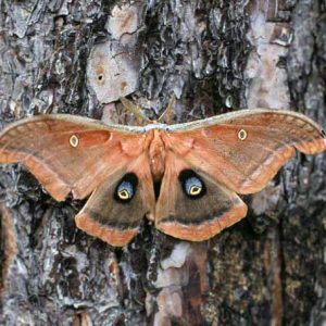 Polyphemus Moth
501-918-3025
calsfoundation@cals.org
calsfoundation@cals.org
| Location: | Logan County |
| Size: | 2,234 acres |
Mount Magazine State Park is located on the highest peak in Arkansas, Mount Magazine, which is a plateau rising out of the Arkansas River Valley to an elevation of 2,753 feet above sea level. The steepness of the elevation change, roughly 2,200 feet between its summit and the surrounding valleys, produces dramatic views that attract tourists.
Native Americans did not live on the mountain year-round, instead settling at lower elevations near the Arkansas and Petit Jean rivers. However, six sites dating to the Archaic period, from 9,500 to 650 BC, have been recorded on Mount Magazine. Near the top of the mountain, in a bluff shelter, artifacts from the Woodland and Mississippian cultural periods have been found, consisting mostly of pottery shards, animal bones, and mussel shell fragments. However, rock flakes and projectile points made from material from both the Ozark and Ouachita mountains have also been discovered, indicating that trade took place both north and south of the mountain.
The first white settlers, mostly from other states and Western Europe, arrived in the Mount Magazine area in the mid-nineteenth century, and major settlement took place from 1850 to 1930. Outsiders discovered the area’s resort potential during the same period, as tourists began seeking locales for recreation or rejuvenation, often medicinal springs or mountaintops.
In 1900, the town of Magazine was platted on the mountain, and, in subsequent years, hotels began to operate there. Magazine was a popular destination for in-state and out-of-state visitors. A railroad along the base of the mountain on the south side helped foster tourism. However, the town foundered during the Depression when development and recreation halted, and hotels fell into disrepair.
The federal government acquired the mountain in 1934 under the United States Resettlement Administration, which was established to resettle the poor into planned communities built by public works projects, and turned the mountain over to the U.S. Forest Service. The Works Progress Administration began building a good gravel road over the mountain from Paris (Logan County) to Havana (Yell County). The civil engineer who supervised the road project was James W. Hardy. After he died, his remains were buried on the south side of the mountain near the road he built; his monument still stands today. Developments undertaken by the Civilian Conservation Corps (CCC) between 1938 and 1941 included a lodge, a restaurant, cabins, campsites, and picnic areas.
The CCC lodge burned in 1971, but strong local and regional support emerged to reestablish facilities on Mount Magazine. By the mid-1970s, both the Forest Service and the state had completed feasibility studies of proposals to turn the mountain into a state park. In 1983, the Arkansas General Assembly approved the formal request made in 1977 by then-governor David Pryor and then-senator Dale Bumpers to turn the mountain over to the state parks system. The state park opened in 2001, although the U.S. Forest Service still owns and manages the land. The Arkansas Department of Parks and Tourism operates and maintains the park’s amenities.
The park, covering about 2,200 acres on top of the mountain, contains picnic areas, pavilions, campgrounds, and a visitors’ center/gift shop. Cabins and a lodge with sixty rooms (all of which offer views of the Petit Jean River valley and Blue Mountain Lake to the south), a conference facility, a restaurant, a fitness room, and a 1,325-square-foot indoor pool are also available. The mountain affords many recreational opportunities—stargazing, hang-gliding, horseback riding, hiking, camping, rock climbing, rappelling, and even ice climbing when weather conditions permit. The mountain’s main road includes bicycle lanes.
The average annual temperature is six degrees cooler on the summit than in surrounding areas, and summer temperatures are frequently ten to fifteen degrees cooler than in surrounding valleys. The mountain is a flat-topped plateau rimmed by sandstone bluffs. On the plateau are two minor peaks: Signal Hill, the highest point in Arkansas at 2,753 feet, and Mossback Ridge, slightly more than 2,700 feet. Major topographic areas of Mount Magazine are the summit, bluff lines, rocky slopes, and foothills.
Mount Magazine is recognized as an area of unique ecological and botanical features. The mountain’s altitude, climate, and geology contribute to its variety of plants and animals and create a wide variety of habitats within a small area.
The rocky slopes formed by the removal of softer, more easily eroded shale on the mountain’s steep sides cause the more resistant sandstone capping the mountain to break off and accumulate along the flanks. This provides an ideal habitat for the threatened Magazine Mountain shagreen snail. Large populations of black bears and white-tailed deer can be found on Mount Magazine. The rufous-crowned sparrow lives in the mountain’s glade-type grassland and is listed by the Arkansas Audubon Society as a rare species in the state.
The park once held the annual Mount Magazine International Butterfly Festival, typically occurring each June, but no longer does. Mount Magazine has a diverse butterfly population with ninety-four out of the 134 species in Arkansas inhabiting the mountain, including the rare Diana fritillary. Enthusiasts from around the world gather to enjoy the festival, which takes place on the Paris town square and at Mount Magazine State Park.
For additional information:
Arkansas State Parks–Mount Magazine. http://www.mountmagazinestatepark.com/ (accessed August 16, 2023).
Hughes, Dave. “New Mount Magazine Lodge Opens to First Customers.” Arkansas Democrat-Gazette, May 2, 2006, pp. 1B, 5B.
Staff of the Arkansas Department of Parks and Tourism
Staff of the CALS Encyclopedia of Arkansas


Comments
No comments on this entry yet.